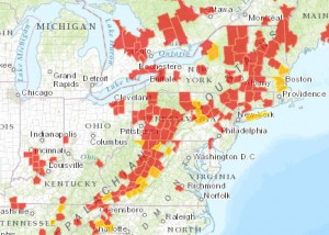
Watch the Spread of White-nose Syndrome with New Story Map
A new story map showing the rapid spread of White-nose Syndrome has just been released by Bat Conservation International.
The project, put together in conjunction with the Pennsylvania Game Commission and ESRI, allows visitors easily visualize the geographic progression White-nose Syndrome across North America.
Additional features allow users to overlay the ranges of threatened bat species over the map to see how they are being affected.
Let’s hope that this useful project will be maintained and updated to include new data in the future.


Comments (1)
The application was assembled and published by Esri (not ERSI). It can be viewed here:
http://storymaps.esri.com/stories/2012/whitenose/
Data was obtained from Bat Conservation International and Cal Butchkoski of the Pennsylvania Game Commission.
Comment